Current Temperature
29.4°C
Crime stats to be featured on county website
Posted on October 2, 2018 by Sunny South News Sunny South News file photo.
By Nikki Jamieson
Sunny South News
Visitors to the county website will soon have an idea on what crime happens in the area.
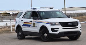
During their regular Sept. 20 meeting, Coaldale RCMP Staff Sgt. Glenn Henry and Picture Butte RCMP Sgt. Tom Howell met with Lethbridge County council to discuss the Public Crime Mapping Project.
Henry said that Public Crime Mapping Project is starting to roll out through the division, and inquired as to whether the county would be interested in participating in it.
“It’s not something new, it’s been done by our municipal agencies in Alberta and elsewhere for quite a number of years. The Lethbridge Police Service have done it, the Calgary Police Service have put in a weekly paper type-thing. This Crime Mapping project is simply a two-week snapshot of crime stats in particular areas, jurisdictions,” said Henry, adding he had made presentations to both the Coaldale and Coalhurst town councils, and they would like to proceed with it. “The Crime Mapping Project is Alberta based — it’s within K division, RCMP. It’s strictly voluntary. What they’re going to do is roll out the stats, we’re going to put our stats onto the map for our particular areas.”
If a municipality wishes to not take part, they will simply “grey out that area” on a map, and say no data is available.
The RCMP will post the map to the municipality’s website, and will perform all the information adding and updating of the map. The website, however, will need to be able to support the map, but there is no additional cost to the municipality.
“The parameters are we’re going to be mapping things like thefts of motor vehicles, thefts from motor vehicles, break and enters, mischiefs. We can put missing persons on there, and we can also flag if we have an emergency situation, that type of stuff,” said Henry. “The idea behind this project is to allow residents to access, the county website in this case, and see what crime rates are about within a two week snapshot.
“It’s kind of a catch-22; we’re not trying to say that crime is out of control, but I think we would also like to tell people that there is crime in our communities. So, it can be a public awareness piece.”
Howell notes that one problem they’re facing is people are telling them one thing but their stats are telling them something else
“It’s almost like policing by Facebook. As soon as everyone gets on Facebook, social media, and says that this is what’s happening, but our statics don’t reflect that,” said Howell.
“What we would like to try and do here is, in a sense, have that information out there for the public. So it’s going to be on a map, these things are generally happening, and how many that are happening.
“It tales away some of the misinformation out there. It’s happened a couple of times in my area, and I’m sure it’s happened in the Coaldale area as well.”
Noting that he still needs to present the proposal to other councils, Howell said he supported the initiative.
“I think it will help you as councilors too. Because you hear from your citizens, saying ‘This is rampant in this area’ and this and that. You have that map there and say, ‘Well, this is what’s reported to the police’. This is the accuracy we’re getting, and I think that will be beneficial to you as well.”
Coun. Klass Vander Veen noted that for the stats to be accurate, it would be important for people to report suspicious activity. Howell said it was important to report, as it gives them a better idea of what’s going on in an area and how to stop it.
“Accurate information is critical for that.”
Henry agreed with Howell, noting “in our world, if it’s not reported, it didn’t happen”.
“I think people out there also need the awareness that yes, crime does happen in their community, rural communities as well, and it’s happening all over the place,” said Henry. “On the flip-side, it’s not, we’re not at a crisis point here either.”
Howell also said that it would help with transparency to citizens, and will help hold them to account.
CAO Ann Mitchell asked how many categories the calls on the map would be divided up into. Henry said there would be four to five different categories.
One thing that could be helpful council to see, Henry said, was that the City of St. Albert served as the pilot for this project, and people could check out the map on their website, cautioning that there will be more calls as St. Albert has a bigger population.
Henry also assured that if there was a theft of a vehicle, it wouldn’t be marked right in front of someone’s house on a map, so they wouldn’t be identifying individual houses.
Howell added that the map would only be dealing with property offenses such as thefts, and not personal offences such as assaults.
Council passed a motion to add the RCMP Public Crime Mapping Project to their website.
Leave a Reply
You must be logged in to post a comment.

